Though you may have seen tides before, you haven’t seen tides like those in the Bay of Fundy. The tides are so extreme partly because of the shape of the bay, which is at its widest in the Gulf of Maine, between Maine and Nova Scotia, and at its most narrow in the north, where the land of New Brunswick and Nova Scotia connect, just south of Prince Edward Island. It’s like the shape of a cornucopia, which is fitting considering the amount of life in the bay.
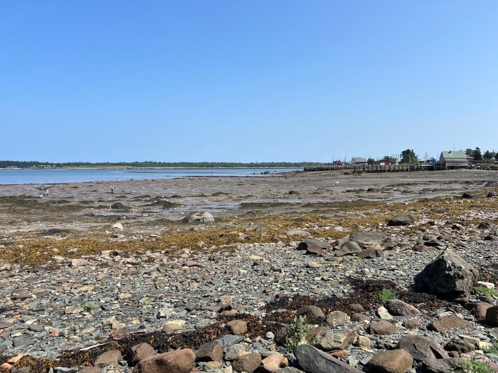
Low tide in August at Seaside Haven Cottages.
Water flows in and out of the bay four times a day, about 6 hours apart. These tides help determine activities on the island, such as clamming, biking on Ross’s Island, or swimming at Deep Cove.
It can be difficult to understand why the tides in the Bay of Fundy are so extreme. Here’s an explanation according to Parks Canada: “Fundy’s tides are the highest in the world because of an unusual combination of resonance (or seiche) and the shape of the bay. Like water in any basin, the water in the Bay of Fundy has a natural rocking motion called a seiche. You could compare this to the movement of water in a bathtub.”

High tide in August at Seaside Haven Cottages. The high tide water mark is about 115 steps, or 250 feet, from Seaside Haven Cottages.
It’s also worth noting that tides are not always the same. Twice a month there are “spring tides,” in which the high tide is highest, and the low tide is lowest. It’s at these extreme low tides that some beachcombers visit various spots on Grand Manan to seek sand dollars, starfish (or sea star), and Sea Urchin. (Note: Brown sand dollars are alive. White sand dollars are not.)
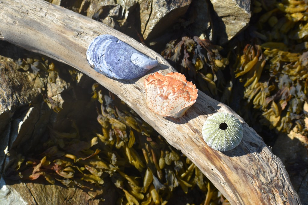
Colorful shells at Ox Head Nature Conservancy preserve, near Seaside Haven Cottages.
